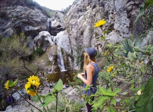
The Best Hiking in Azusa
Looking for the best hiking in Azusa? We've got you covered with the top trails, trips, hiking, backpacking, camping and more around Azusa. The detailed guides, photos, and reviews are all submitted by the Outbound community.
Top hiking spots in and near Azusa
-
Azusa, California
Gabriel Bike Trail: Azusa to Seal Beach
39.42 mi / 440 ft gainGabriel Bike Trail: Azusa to Seal Beach is a point-to-point trail where you may see beautiful wildflowers located near Azusa, California.Read more -
Duarte, California
Mt. Bliss: Van Tassel Trail
10.54 mi / 3248 ft gainMt. Bliss: Van Tassel Trail is an out-and-back trail where you may see beautiful wildflowers located near Duarte, California.Read more -
Azusa, California
San Gabriel River Bike Path-San Gabriel Canyon to Seal Beach
37.5 mi / 190 ft gainSan Gabriel River Bike Path-San Gabriel Canyon to Seal Beach is a point-to-point trail primarily used for running and biking with views of the pacific once you reach Seal Beach, CA.Read more -
Azusa, California
Fish Canyon Falls
2.04.08 mi / 801 ft gainThis trail is currently closed! Learn more on the U.S. Forest Service website. Follow Encanto Parkway towards the hills until you come to a junction with a sign labeled "trail" that points towards a parking lot to your right. Parking is free, though on weekends it may be difficult to find a spot...Read more -
Irwindale, California
Santa Fe Dam Loop Trail
4 mi / 105 ft gainSanta Fe Dam Loop Trail is a loop trail where you may see beautiful wildflowers located near Baldwin Park, California.Read more -
Glendora, California
South Hills Wilderness Area
2.06 mi / 351 ft gainSouth Hills Wilderness Area is a loop trail where you may see beautiful wildflowers located near Glendora, California.Read more -
Glendora, California
Colby Trail
1.43 mi / 518 ft gainColby Trail is an out-and-back trail that takes you past scenic surroundings located near Glendora, California.Read more -
Glendora, California
Colby and Dalton Trail Loop
2.51 mi / 725 ft gainColby and Dalton Trail Loop is a loop trail where you may see beautiful wildflowers located near Glendora, California.Read more -
Monrovia, California
Duarte Recreational Trail
3.27 mi / 46 ft gainDuarte Recreational Trail is an out-and-back trail that takes you past scenic surroundings located near Duarte, California.Read more -
Glendora, California
Little Dalton Canyon via Lower Monroe Trail
3.78 mi / 935 ft gainLittle Dalton Canyon via Lower Monroe Trail is a loop trail that is moderately difficult located near Glendora, California.Read more -
Glendora, California
Lower Monroe Truck Trail
15.94 mi / 3527 ft gainLower Monroe Truck Trail is a point-to-point trail where you may see wildflowers located near Glendora, California.Read more -
Glendora, California
Glendora Mountain Road Mountain Biking Trail
17.42 mi / 2976 ft gainGlendora Mountain Road Mountain Biking Trail is an out-and-back trail where you may see beautiful wildflowers located near Glendora, California.Read more -
Glendora, California
Poop Out Trail
4.84 mi / 1624 ft gainPoop Out Trail is a loop trail where you may see wildflowers located near Glendora, California.Read more -
Glendora, California
Upper Monroe Truck Trail
12.14 mi / 2900 ft gainUpper Monroe Truck Trail is an out-and-back trail where you may see beautiful wildflowers located near Glendora, California.Read more -
Glendora, California
Lower Monroe Trail
4.69 mi / 922 ft gainLower Monroe Trail is an out-and-back trail that is moderately difficult located near Glendora, California.Read more -
Glendora, California
Glendora Ridge Motorway
7.87 mi / 1476 ft gainGlendora Ridge Motorway is an out-and-back trail where you may see local wildlife located near La Jolla, California.Read more


